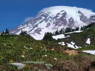
 Mount Rainier from Paradise Meadows, August, 2011
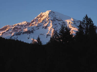
In the heart of the Pacific Northwest, a great volcano smolders beneath an icy cloak. Perched more than 14,000 feet above a lowland plain molded and swept by recent glaciers, on modern maps the mountain is named "Rainier" in honor of a man who never saw it. To the earliest inhabitants it was "Tahoma." To residents within its sphere of influence, it is simply "The Mountain."
Mount Rainier dominates the surrounding landscape. It can be seen from lowland bridges crossing great lakes in bustling cities, from urban residents’ back yards, from high ridges a hundred miles away. Ominously close to densely populated lands, the mountain has inflicted its wrath on earlier residents, burying river valleys in giant swaths of mud, making the land fertile for future inhabitants. Within the mountain, volcanic fires have flared repeatedly, decapitating old summits and remaking the landscape. Climb to the top and seek shelter within steamy caves warmed from below. In forested valleys, hot springs hint that the mountain is not dead. -- from the introduction to The Trees of Mount Rainier, by Susan McDougall |
During the 2014 season, Susan undertook a volunteer project for the National Park Service. Taking more than a dozen trips to the Park, she photographed 475 native species - more than 1900 photographs altogether. These have been donated to the Park Service, along with GPS and other data, for use by Park staff. A sampling of these pictures, shown against Google Earth maps, can be seen here:
In 2015 and 2016 more photographs of native plant species were taken. At this time, approximately 603 of the 750+ species have been photographed.
|
The Mount Rainier books, including sample chapters and sections from each:
Flora of Mount Rainier National Park, by David Biek
The Trees of Mount Rainier, by Susan McDougall
Flora of Mount Rainier National Park, by David Biek
The Trees of Mount Rainier, by Susan McDougall
